District Maps
These district maps display school locations by grade level, by elementary feeder schools for middle and high schools, and by approximate district boundaries for each school.
|
|
|
|
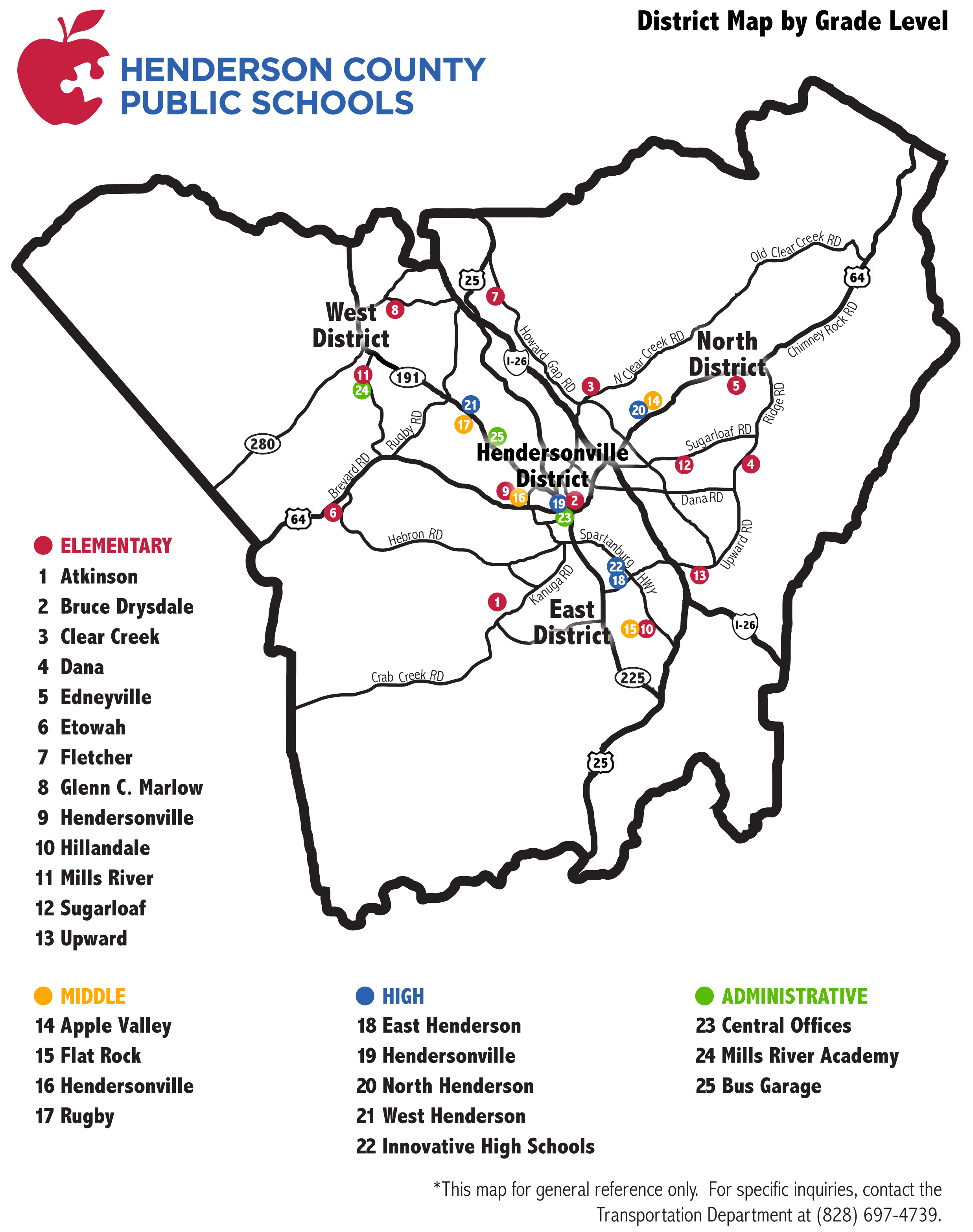
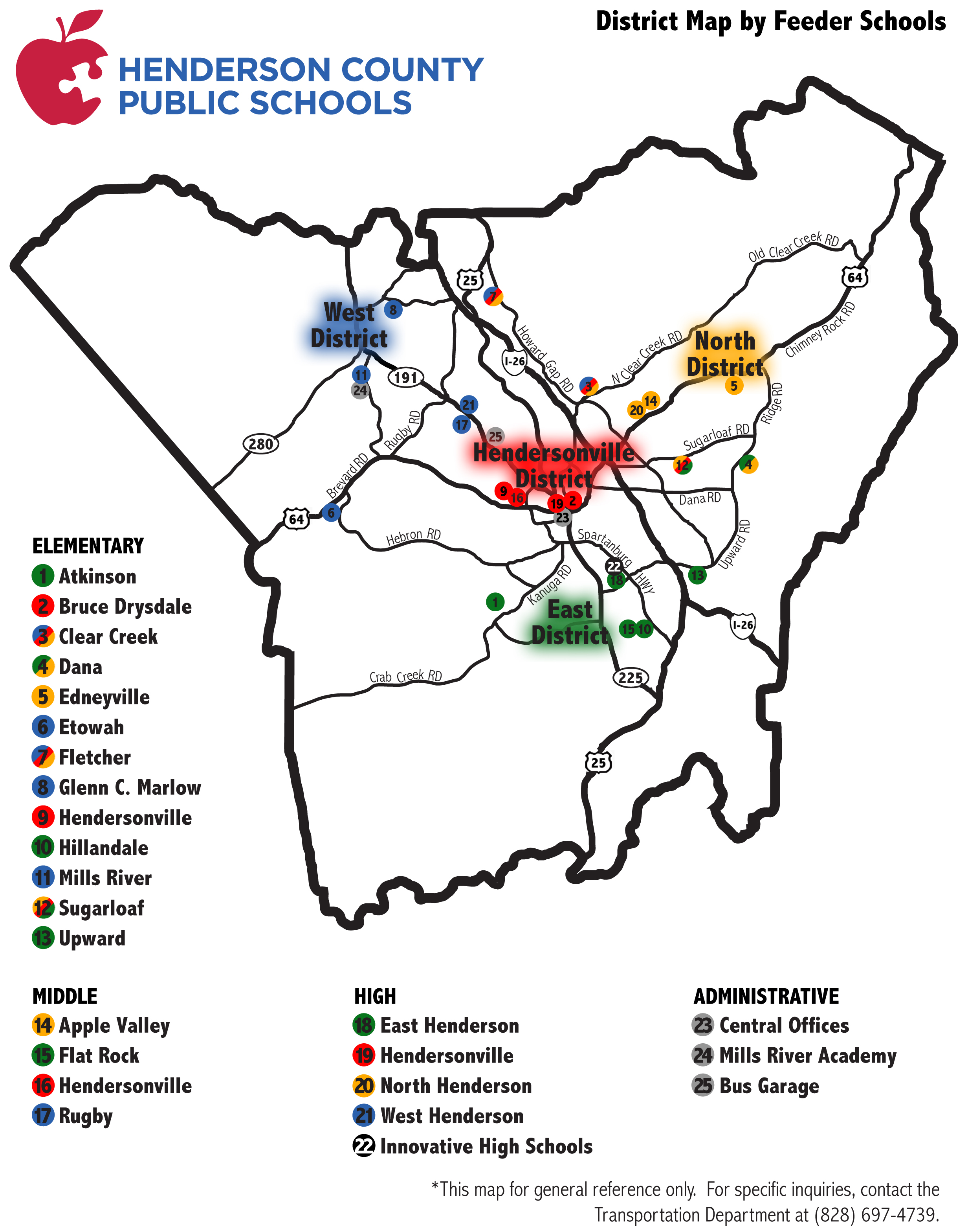
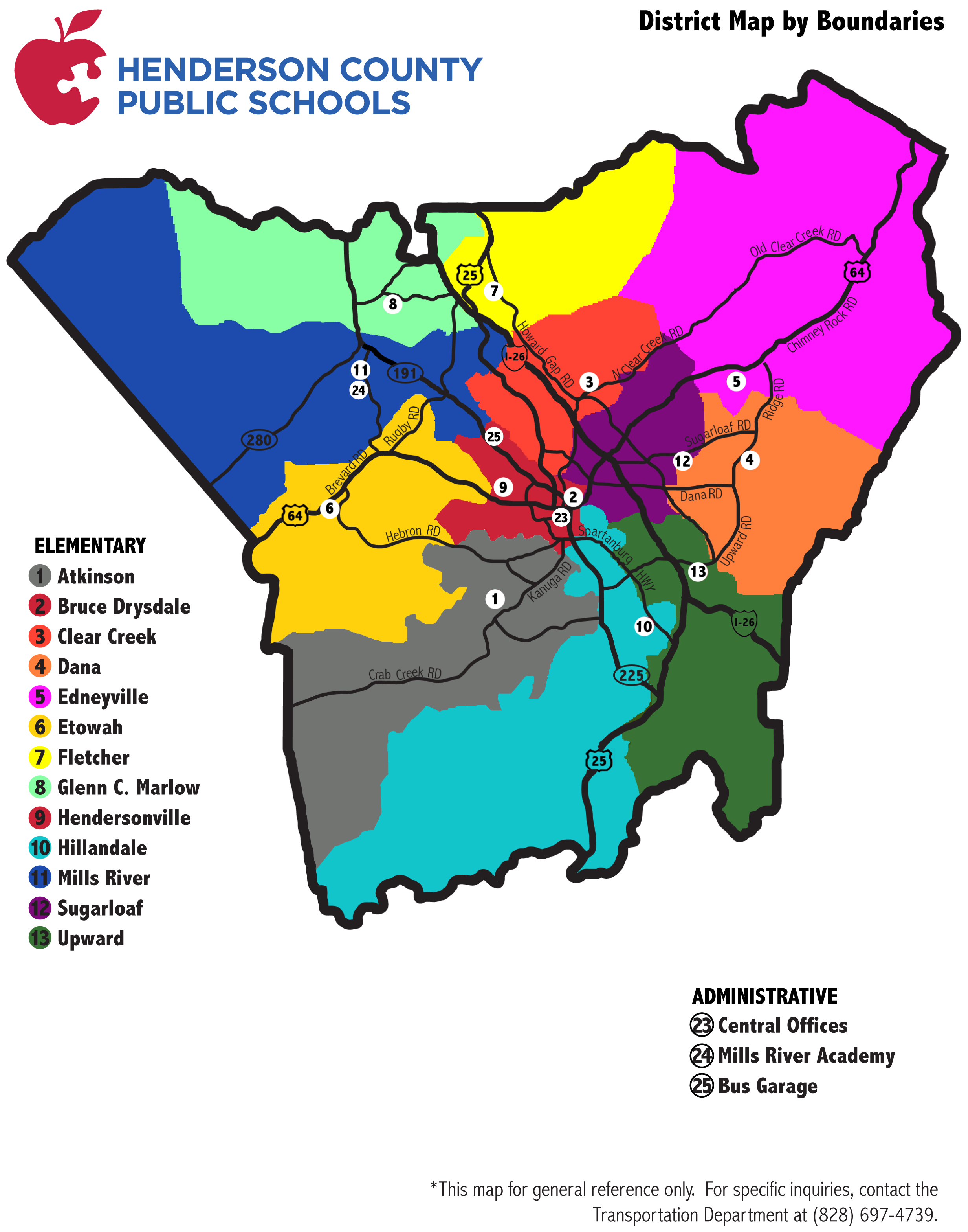
Please note that a student’s school assignment is determined by the street address of his/her residence, and individual district lines are complex. As an additional tool, you can access school district Map Layers in Henderson County’s GIS mapping system. As an alternative to the color-coded maps, use Henderson County’s Online GIS/Mapping System to search school district information for an individual property address or to filter a geographic area by specific school district boundaries.
For specific questions regarding your student’s school assignment, please contact the Transportation Department at 828-697-4754.